


Manali to Leh Highway Road Trip Guide 2026: Route, Stops, Distance, Cost & Biker Tips

Manali to Leh Highway Road Trip Guide 2026 planning usually starts with one confusing detail: nobody can agree on the distance. Some sites say 428 km, others say 475 km, and that gap alone can throw off your fuel math and your itinerary. Since the Atal Tunnel became fully operational, the real number for 2026 is closer to 428 km door to door, cutting out the old Rohtang Pass climb entirely. In my experience planning tours at Astamb Holidays, most trip disasters trace back to travelers using outdated route data from before 2020. This guide walks through the current NH-3 alignment, every major stop, realistic driving times, fuel planning across the 365 km dead zone, and what it actually costs by bike, car, or taxi in 2026.
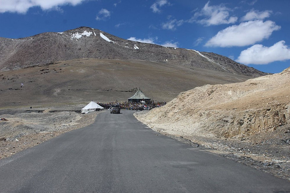
📊 Manali to Leh Highway 2026 at a Glance
Here's the fastest way to understand the route before you dive into the details below.
Detail | 2026 Information |
Total Distance | ~428 km via Atal Tunnel |
Route Alignment | NH-3 (Manali–Leh Highway) |
Total Major Passes | 4 (Baralacha La, Nakee La, Lachulung La, Tanglang La) |
Highest Altitude Point | Tanglang La at 17,480 ft (5,328 m) |
Last Petrol Pump (Manali side) | Tandi, near Keylong |
First Petrol Pump (Leh side) | Karu, close to Leh |
Minimum Travel Time | 2 Days (not recommended for first-timers) |
Best Overnight Stop | Jispa (10,500 ft) |
Mobile Network Status | Patchy; BSNL has widest reach, Jio works in pockets |
Permit Requirement | None for the highway itself; Rohtang Pass permit only if detouring to the pass |
Road Season | Roughly mid-May to early November |
🗺️ What Is the Manali to Leh Highway Route in
2026?
The modern NH-3 alignment no longer forces you over Rohtang Pass. Since the Atal Tunnel opened in October 2020, the entire route runs through the tunnel and down into Lahaul Valley, which shaved close to 46 km and 3 to 4 hours off the old road. What used to be a nerve-wracking climb to nearly 13,050 ft is now a flat, all-weather 9-km drive under the mountain.
Manali to Atal Tunnel and Sissu
You leave Manali and climb gently past Palchan and Solang Valley before entering the 9.02 km Atal Tunnel, which caps speeds at 40 kmph. On the far side, the road drops into Sissu, a green pocket at 10,270 ft that already feels like a different world.
Sissu to Tandi and Keylong
From Sissu, the highway runs downhill toward Tandi, where the Chandra and Bhaga rivers merge into the Chandra-Bhaga. This is your last fuel stop for thousands of the toughest kilometers ahead, so top up here without exception. Keylong, the district headquarters of Lahaul and Spiti, sits just 8 km further.
Keylong to Jispa and Darcha
Jispa is a quiet riverside village that most experienced operators, including us at Astamb Holidays, recommend as the first night halt. Darcha marks the last real settlement before the climbs begin, and it's also where an occasional police checkpost logs vehicle details heading toward Ladakh.
Darcha to Baralacha La and Sarchu
Beyond Darcha, the road climbs hard toward Baralacha La at 16,040 ft, a pass that can hold snow even in July. Sarchu, right after, sits at nearly 14,000 ft — a number that surprises a lot of travelers who assume it's a safe midpoint.
Sarchu to Pang via Gata Loops
This stretch includes the famous Gata Loops, a set of 21 hairpin bends that gain altitude fast. Nakee La and Lachulung La follow in quick succession before the road drops into the barren camp of Pang.
Pang to Leh via More Plains and Tanglang La
From Pang, the highway opens into the flat, high-altitude More Plains, then climbs one final time to Tanglang La at 17,480 ft — the highest point on the entire route. After that, it's a long, steady descent through Upshi and Karu into Leh.
Local Insight Tip: Water crossings near Pagal Nallah and Zingzing Bar turn genuinely dangerous by mid-afternoon once the sun melts glacier snow upstream. Cross before 11 AM whenever you can, especially on a bike.
📏 How Far Is Manali to Leh in 2026?
The short answer: it's 428 km via the Atal Tunnel, not the 474–490 km figure you'll still see floating around online. That older number describes the pre-2020 route over Rohtang Pass, which many outdated blogs never updated.
Why Some Websites Say 430 km and Others Say 475–490 km
The confusion comes down to timing. Sites written before 2020 measured the Rohtang Pass route, while newer guides reflect the Atal Tunnel shortcut. Both numbers are "correct" — they're just describing two different roads.
Atal Tunnel vs Old Rohtang Route
The Rohtang Pass route ran roughly 116 km just between Manali and Keylong and took 5 to 6 hours in good weather. The Atal Tunnel route covers that same stretch faster and skips the pass's frequent avalanche and traffic jam problems entirely.
How Long Does 430 km Actually Take?
On paper, 430 km sounds like a five-hour drive. In the Himalayas, it's a 13 to 15 hour haul if attempted in one go, which is exactly why nobody experienced recommends doing it that way.
Distance Segment | Terrain Type | Approx. Driving Time |
Manali to Sissu (via tunnel) | Tunnel + hill road | 1.5–2 hours |
Sissu to Jispa | Valley road | 1.5 hours |
Jispa to Sarchu | High pass, rough patches | 4–5 hours |
Sarchu to Pang | Loops, high passes | 4–5 hours |
Pang to Leh | Plains + final pass | 4–5 hours |
📅 Manali to Leh Road Trip Itinerary: 2 Days or 3 Days?
Both are possible, but they suit very different kinds of travelers.
2-Day Fast Itinerary
Day 1: Manali → Jispa (~100 km, easy ride, acclimatize overnight)
Day 2: Jispa → Leh (~327 km, the long haul across all four passes)
3-Day Balanced Itinerary
Day 1: Manali → Keylong or Jispa
Day 2: Jispa → Sarchu or push on to Pang
Day 3: Pang → Leh
Which itinerary suits first-time travelers?
The 3-day plan suits almost everyone new to high altitude. Splitting Day 2's brutal 327-km stretch reduces both fatigue and AMS (Acute Mountain Sickness) risk considerably.
Factor | 2-Day Itinerary | 3-Day Itinerary |
Acclimatization Safety | Lower | Higher |
Daily Driving Hours | Up to 12 hrs on Day 2 | 6–8 hrs per day |
Sleep Altitude Progression | Steep jump | Gradual |
Local Insight Tip: What we often see on the ground is travelers arriving in Leh exhausted and skipping their first day's acclimatization rest because they're wiped out from a rushed 2-day drive. Build the buffer in.
🏔️ Best Stops on the Manali to Leh Highway
Sissu
A green, glacier-fed village right after the tunnel, good for a short breakfast halt.
Keylong
The largest town on the route with basic ATMs, fuel, and phone connectivity.
Jispa
The safest and most recommended overnight halt for acclimatization at 10,500 ft.
Baralacha La
A genuine high pass at 16,040 ft where snow can appear even in peak summer.
Sarchu
Scenic camping ground, but sleeping here unacclimatized is risky given the 14,000 ft elevation.
Gata Loops
21 hairpin bends that climb fast — a favorite photo stop for bikers, but not a place to linger in fog.
Pang
A remote army-linked camp that works well as a safer overnight alternative to Sarchu.
More Plains
A flat, open high-altitude stretch that feels almost lunar after the loops.
Tanglang La
The highest point of the drive at 17,480 ft, with a small tea stall and prayer flags at the top.
Local Insight Tip: At Gata Loops and Sarchu, altitude sickness symptoms show up faster than people expect. If you feel a headache building, stop, hydrate, and don't push through it just to "make good time."
🛠️ Manali to Leh Highway Road Conditions in 2026
What road conditions should you expect?
The stretch from Manali to the Atal Tunnel is smooth tarmac. Conditions get progressively rougher past Darcha, with loose gravel, broken patches, and water crossings becoming normal past Baralacha La.
Where are water crossings and rough sections most likely?
Expect meltwater streams (locally called nallahs) near Zingzing Bar, Pagal Nallah, and stretches close to Baralacha La. BRO has bridged many of these, but a few remain genuine crossings, especially in early season.
How to verify the road before departure
Check live BRO updates, local Manali or Leh taxi union groups, and recent traveler posts before you leave. A road that was fine yesterday can flood overnight after heavy rain.
What should you do if the highway temporarily closes?
Wait it out at the nearest safe settlement rather than attempting an unofficial detour. BRO teams typically clear landslides and flash-flood debris within the same day during peak season.
☀️ Best Time for Manali to Leh Highway in 2026
May
The highway typically reconnects in mid-May 2026, but early-season melt makes water crossings unpredictable and camps may not be fully operational.
June
Roads are fully open with unrestricted civilian traffic, though water crossings from snowmelt peak this month.
July
Monsoon can trigger brief landslide halts near Rohtang, Gulaba, and Keylong on the Manali side, while the Darcha to Leh stretch stays largely dry since it sits in the rain shadow.
August
Similar monsoon watch-outs as July on the Himachal side; the Ladakh side of the route generally stays clear.
September
Widely considered the sweet spot — stable roads, thinning crowds, and crisp visibility, especially favored by bikers.
October
Good riding weather early in the month, but temperatures drop fast and the road typically closes by late October or early November.
Month | Road Status | Snow Walls | Rain Risk | Temperature | Crowd Level |
May | Just opened | High | Low | Cold | Low |
June | Fully open | Moderate | Low | Mild | High |
July | Open | Low | Moderate (Manali side) | Warm days | High |
August | Open | Low | Moderate (Manali side) | Warm days | High |
September | Open, stable | None | Low | Cool | Moderate |
October | Closing soon | Returning | Low | Cold | Low |
🩺 Manali to Leh Highway Altitude and Acclimatization
Why altitude matters more than distance
A 100 km stretch in the plains might take 90 minutes; the same distance here can take five hours because of altitude, road quality, and constant gear-shifting. But the bigger risk isn't time lost — it's your body's reaction to thin air above 11,000 ft.
Jispa vs Sarchu overnight
Sarchu sits at nearly 14,000 ft, actually higher than Leh itself. Sleeping there without prior acclimatization is one of the most common causes of AMS on this route, so Jispa at 10,500 ft remains the safer first-night choice.
When to slow down or change your plan
If anyone in your group develops a persistent headache, nausea, or breathlessness at rest, stop climbing immediately. Descending even a few hundred meters can reverse early AMS symptoms fast.
Location | Altitude (ft) | Altitude (m) |
Manali | 6,725 | 2,050 |
Sissu | 10,270 | 3,130 |
Tandi | 8,430 | 2,570 |
Keylong | 10,100 | 3,080 |
Jispa | 10,500 | 3,200 |
Baralacha La | 16,040 | 4,890 |
Sarchu | 14,070 | 4,290 |
Nakee La | 15,547 | 4,739 |
Lachulung La | 16,616 | 5,065 |
Pang | 15,200 | 4,630 |
Tanglang La | 17,480 | 5,328 |
Leh | 11,500 | 3,500 |
⛽ Fuel Stops on the Manali to Leh Highway
Tandi fuel stop
This is your last guaranteed petrol pump on the Manali side. Skip it, and you're gambling with a fuel dead zone that stretches for hundreds of kilometers.
Karu fuel stop
On the Leh side, Karu is typically the first reliable pump you'll hit after crossing Tanglang La and Upshi.
How to calculate your vehicle's range
Multiply your tank capacity by your bike or car's real-world mileage at high altitude, which usually drops 15 to 20% compared to plains driving due to thinner air and constant low-gear climbing.
Fuel contingency planning
Always carry extra fuel in approved cans, especially on a motorcycle. In my experience managing tours at Astamb Holidays, this single precaution has saved more trips than any other piece of gear.
The 365 km fuel dead-zone: Between Tandi and Karu, there is no dependable petrol pump for roughly 365 km. This single stretch is the reason every serious Manali–Leh checklist puts "extra fuel" near the top.
🏍️ Manali to Leh by Bike: 2026 Rider Guide
Motorcycle suitability
A Royal Enfield 350 or 500cc remains the most popular choice thanks to ground clearance and easy servicing along the route. Smaller commuter bikes struggle with loaded luggage on rough patches.
Riding preparation
Get a full service done in Manali before departure, not after you leave. Check brakes, chain tension, and tire condition specifically for water-crossing grip.
Spare-parts and puncture planning
Carry a puncture repair kit, spare clutch cable, and basic tools. Mechanics exist in Keylong and Leh, but almost nowhere reliably in between.
Rental-bike considerations
Rental motorcycles picked up in Manali are generally restricted to NH-3 itself. Checkpoints at South Pullu and North Pullu turn commercial rental bikes back from entering Nubra Valley, Pangong Tso, or Hanle — you'll need a locally registered bike in Leh for that sightseeing circuit.
Bike-trip budget
Expect fuel, basic homestays or camps, food, and minor repairs to form your core costs, detailed in the cost section below.
Local Insight Tip: For water streams near Pagal Nallah, keep your engine revs steady and don't stall mid-crossing. Walk the crossing first on foot if you're unsure of the depth.
🚘 Manali to Leh by Car, Taxi or Bus
Self-drive car
Works well with a capable SUV and an experienced co-driver, but altitude driving fatigue is real — don't underestimate it.
Private taxi
The most comfortable option for families, usually booked as a one-way or round trip through registered Himachal or Ladakh taxi unions.
Shared taxi
The most budget-friendly option for solo travelers or backpackers willing to split a seat with strangers.
Bus
HRTC's seasonal Delhi-Leh service via Keylong runs once the road is fully open, offering the cheapest way to cover the distance without driving yourself.
Which option fits different traveler profiles?
Traveler Type | Best Option |
Solo backpacker | Shared taxi or bus |
Riding enthusiast | Motorcycle |
Family with kids | Private taxi |
Small self-drive group | Self-drive SUV |
💰 Manali to Leh Road Trip Cost 2026
Costs vary by travel mode, but here's a realistic breakdown in INR for planning purposes.
Motorcycle budget
Fuel, basic camps or guesthouses, food, and minor repairs typically run in the ₹8,000–₹15,000 range per person for a 3-day one-way trip, excluding bike rental.
Self-drive budget
Between fuel, tolls, stays, and food, a self-drive group can expect roughly ₹6,000–₹12,000 per person, depending on vehicle sharing.
Shared taxi budget
This remains the cheapest organized option, often falling between ₹3,500–₹6,000 per seat one-way.
Private taxi budget
A private taxi for the full one-way stretch generally costs ₹18,000–₹28,000 for the vehicle, shared across passengers.
Emergency contingency budget
Always keep an additional ₹3,000–₹5,000 aside for unexpected repairs, extra fuel, or a forced extra night due to road closure.
Traveler Mode | Approx. Cost (per person, one-way) |
Motorcycle | ₹8,000–₹15,000 |
Self-drive car | ₹6,000–₹12,000 |
Shared taxi | ₹3,500–₹6,000 |
Private taxi | ₹18,000–₹28,000 (per vehicle) |
📶 Mobile Network, ATMs, Food and Medical Facilities
Location | Mobile Network | ATM | Food | Medical |
Sissu | Patchy BSNL | No | Basic dhabas | None |
Keylong | BSNL, Jio pockets | Yes | Good options | Basic hospital |
Jispa | Patchy BSNL | No | Camp meals | None |
Sarchu | Very limited | No | Camp meals only | Basic first-aid tents |
Pang | Almost none | No | Basic camp food | None |
Upshi | BSNL returns | No | Small dhabas | None |
🏨 Where to Stay Between Manali and Leh
Keylong
Guesthouses and small hotels with reliable rooms and basic amenities.
Jispa
A mix of riverside camps and a few proper hotels, our top recommendation for the first night.
Sarchu
Tented camps only, best treated as a fallback rather than a first choice given the altitude.
Pang
Basic tented setups run seasonally, useful if you're splitting the drive into three days.
🎒 What to Pack for the Manali to Leh Highway
Documents
Valid driving license
Vehicle RC and PUC certificate
Government-issued photo ID
Clothing
Layered thermal wear
Windproof riding or driving jacket
Good-grip waterproof shoes
Vehicle equipment
Extra fuel cans
Puncture repair kit
Tow rope
Navigation and communication
Offline maps downloaded in advance
BSNL SIM for better remote coverage
Power bank
Emergency essentials
Basic AMS medication (as advised by a doctor)
First-aid kit
High-calorie snacks and extra water
⚖️ Manali to Leh vs Srinagar to Leh
Factor | Manali to Leh | Srinagar to Leh |
Distance | ~428 km | ~434 km |
Road Conditions | Rougher, more passes | Smoother, better maintained |
Acclimatization Profile | Sudden altitude gain | Gradual altitude gain |
Scenery | Stark high-altitude desert | Green valleys transitioning to desert |
Season Window | Mid-May to early November | Late March/April to November/December |
If you're prioritizing gentler acclimatization, the Srinagar to Leh highway guide on Xplore Heaven covers that route in detail.
⚠️ 10 Mistakes Travelers Make on the Manali to Leh Highway
Skipping the fuel top-up at Tandi.
Sleeping at Sarchu without prior acclimatization.
Attempting the whole 428 km in a single stretch.
Ignoring afternoon water-crossing risk near Baralacha La.
Not carrying enough cash before Keylong.
Using outdated distance figures from pre-tunnel articles.
Riding a rental bike toward Nubra or Pangong without switching to a local plate.
Underestimating how cold nights get even in July.
Ignoring early AMS symptoms to "keep moving."
Not checking live BRO road status before departure.
✅ Manali to Leh Highway Pre-Departure Checklist
Vehicle serviced and inspected
Fuel tank full, extra fuel cans packed
Documents (license, RC, PUC, ID) ready
Warm layers and rain gear packed
Offline maps downloaded
AMS medication and first-aid kit packed
Live BRO road status checked
Cash withdrawn before leaving Manali or Keylong
Overnight stay booked at Jispa or Keylong
Emergency contact numbers saved offline
🏁 Manali to Leh Highway Road Trip Guide 2026: Final Takeaway
The Manali to Leh Highway rewards preparation more than bravado. Get your fuel math right around the Tandi-Karu dead zone, respect the altitude jump at Sarchu, and build a 3-day itinerary if this is your first time on the route. The road itself, thanks to the Atal Tunnel, is genuinely more forgiving than it was a decade ago — the risks that remain are almost entirely about pacing, planning, and acclimatization, not the highway itself.
If you'd rather have someone handle the ground logistics, Astamb Holidays puts together custom Himalayan itineraries with vetted vehicles and local support. For more seasonal route guides and hidden-gem destinations across the Himalayas, keep exploring Xplore Heaven.
Related Reading on Xplore Heaven:
❓ Frequently Asked Questions (AEO & Voice Search)
How long is the Manali to Leh Highway in 2026? The highway runs approximately 428 km via the Atal Tunnel, down from the older 474 km Rohtang Pass route.
What is the actual Manali to Leh distance via Atal Tunnel? It's roughly 428 km, cutting travel time by 3 to 4 hours compared to the pre-2020 Rohtang Pass alignment.
Why do some websites say Manali to Leh is 475 or 490 km? Those figures describe the older route over Rohtang Pass, before the Atal Tunnel opened in October 2020.
How many days are enough for a Manali to Leh road trip? 3 days is the safest and most recommended duration for first-time travelers, allowing gradual altitude gain.
Can you travel from Manali to Leh in two days? Yes, but it means a grueling 327-km second day across four passes, which increases both fatigue and AMS risk.
Is Manali to Leh Highway open in 2026? Yes, the highway typically opens by mid-May and stays open until late October or early November, weather permitting.
What is the best month for the Manali to Leh road trip? September is widely considered the best month, offering stable roads, thinner crowds, and clear skies.
Where should I stay between Manali and Leh? Jispa is the most recommended first-night stop; Pang works well as a second-night option on a 3-day plan.
Is Jispa better than Sarchu for an overnight stop? Yes. Jispa sits at 10,500 ft while Sarchu sits near 14,000 ft, making Jispa the safer acclimatization choice.
Where are the petrol pumps on the Manali Leh Highway? Tandi is the last pump on the Manali side; Karu is the first reliable pump on the Leh side, roughly 365 km apart.
How much does a Manali to Leh bike trip cost? Expect roughly ₹8,000 to ₹15,000 per person for fuel, stays, and food on a one-way ride, excluding bike rental.
Can a normal car travel from Manali to Leh? Yes, though a higher-clearance SUV handles water crossings and rough patches more comfortably than a low-clearance sedan.
Does mobile network work between Manali and Leh? Coverage is patchy overall; BSNL offers the widest reach, while other networks work only in pockets near larger towns.
What documents are required for the Manali Leh Highway? A valid driving license, vehicle RC, PUC certificate, and photo ID are sufficient; no special permit is needed for the highway itself.
What should I carry for a Manali to Leh road trip? Warm layers, extra fuel, a first-aid kit, AMS medication, offline maps, and high-calorie snacks are the essentials.
Is the Manali to Leh Highway safe for first-time travelers? Yes, with proper preparation, a paced itinerary, and awareness of altitude symptoms rather than rushing the route.
What are the major passes between Manali and Leh? Baralacha La, Nakee La, Lachulung La, and Tanglang La are the four major passes on this route.
Which is better for a Ladakh road trip: Manali or Srinagar? Srinagar offers gentler acclimatization and better road surfaces; Manali offers more dramatic, higher-altitude scenery.
About the Author
Wahid Ali is a seasoned travel professional and Operations Lead at Astamb Holidays, Mumbai. With extensive experience in crafting travel experiences and destination insights, Wahid combines practical travel logistics expertise with engaging storytelling to help travelers explore hidden gems across India and beyond. His work blends expert travel planning with a passion for culturally rich and nature-oriented destinations.
Connect with Wahid Ali on LinkedIn | xploreheaven.com
Disclaimer: Highway opening dates, pass statuses, road conditions, and local regulations on NH-3 are managed by the Border Roads Organisation (BRO) and local district authorities. Always verify live status before departure.


Comments